Rock Ridge Knoll or Little Darcy Mountain

Photo: Rock Ridge Knoll
Photo by Mary Masiel

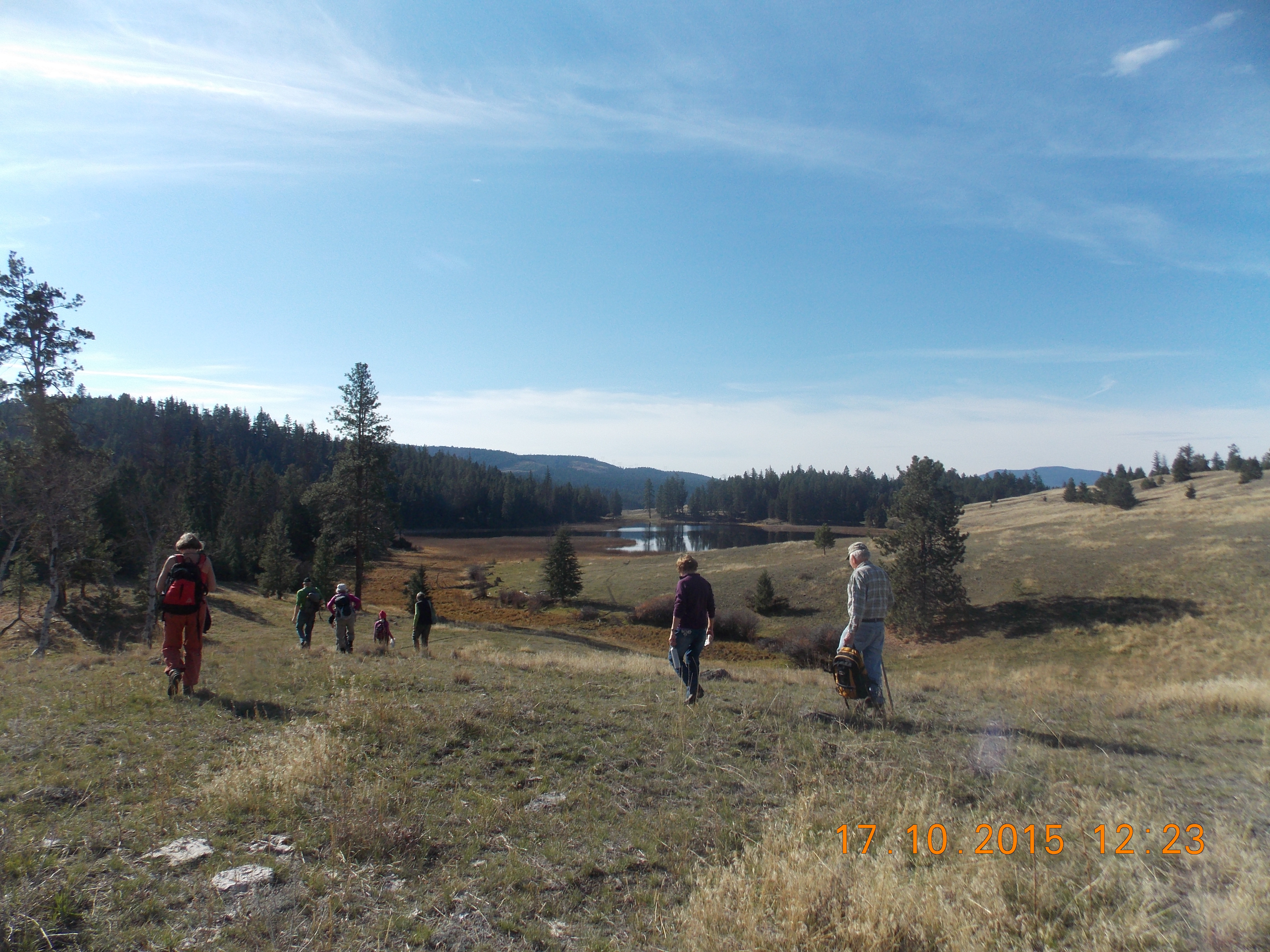
It was a spectacular sunny day, Saturday Feb. 28th at August Lake, as 13 naturalists set out on their outing. It was decided earlier that snowshoes would not be needed as much of the snow was gone, but poles were advised for the icy sections that we would encounter. We took a small logging road south of August Lake and began climbing to reach our destination of Rock Ridge Knoll, a name invented for this outing, but locally known as Little Darcy Mountain. Along the way John Henry gave us a short explanation of timber cruising as we passed a “growth and yield” station. As we walked across the sunny side hills John pointed out that the terrain we were viewing, i.e. the side hills, were left as boulder clay remnants from the end of glaciation. Along the way we came upon an outcropping of rocks containing copper. It was a lovely sight to see all the green and bluey green specimens glistening in the mid morning sun. As we crisscrossed the hills to reach the top, there was plentiful evidence of elk tracks and droppings. Unfortunately, we didn’t see any elk, but a herd of 25 was sighted earlier in the week. All around us we were surrounded by beautiful vistas of snow covered hills or just bared hills. We reached the first knoll, and from out vantage position, we could see the buildings of Rock Ridge and the frozen Lorne Lake below. We meandered across a snow covered hill to reach a second knoll equally spectacular as the first and settled down for lunch. Our return trip took us through an open forest to join an old logging trail, and we carefully made our way down to August Lake.

Swan Lake Snowshoe

Photo: Swan Lake Snowshoe
Photo by Cathy Lahaie

We were lucky the weather held for this snowshoe around Swan Lake. Ten of us set out on the loop around the trails with a stop at the picnic table overlooking the lake, hidden by melting ice and snow. This was a short hike of about 2.5 km lasting around 2 hours. There were a few birds to be seen or heard such as a Bald eagle, Crows, Ravens, Black-billed magpie, Steller’s jay and European starlings.

Secret Lake Snowshoe

Photo: Secret Lake Snowshoe
Photo by Janis Wright

Vermilion Forks Field Naturalists were once again favoured with sunny skies and sufficient snow on our most recent snowshoe outing, Saturday, Jan. 30th. Barb Anstie and Myra Quadling led 17 members and guests along a newly formed trail to Secret Lake, a secluded little spot concealed between Chain and Link lakes. We started up a bald hillside which eventually led to a forested area, through which we followed the winding track as we made our way to the frozen lake. This little piece of paradise features two beaver lodges, which we explored as we enjoyed the rays of the sun, unobstructed in the clearing. There were many tracks to be found in the woods, those of snowshoe hares and moose being most prevalent. The only bird life noted was a bald eagle which gracefully circled above us as we returned to our starting point. Our two-hour trek ended with a cozy gathering around a hearty fire which was personally delivered by local fire chief, Rob Miller! Special thanks to Barb, Myra and Lynne for their leadership and hospitality on this fun-filled field trip!

Snowshoeing at China Ridge

Photo: China Ridge Snowshoe
Photo by Janis Wright

The hills of China Ridge are a virtual winter wonderland right now, as Vermilion Forks Field Naturalists can verify! Fourteen of us, members and guests alike, delighted in a three hour snowshoe outing on Saturday, Jan. 16th, that initially took us uphill from the longhouse for 1 ½ hours. We journeyed through the woods where the trees were laden with snow, and ever higher to a viewpoint, where we looked far south across the Similkameen Valley. John Henry and Mary Masiel led this field trip, and conditions were perfect: the day was calm, temperatures just below freezing, snow soft and slightly packed, just over 2 feet deep at the lookout. Conveniently, there is a picnic table and fire pit close by, and John quickly started a vigorous fire, which effectively kept us warm as we ate our lunches and enjoyed the opportunity to relax. Glimmers of sunshine tantalized us on our return trip, which took us to an east-facing viewpoint, where the old T-bar once operated, and we were able to view Hedley’s Mascot mine. We felt as though we were part of a picturesque Christmas card as we trooped through the snowy forest, feeling the sun shine upon us fully when we returned to our vehicles, exhilarated once again by our fresh air fix!

Swan Lake

Photo: Swan Lake
Photo by Janis Wright

Tip Anderson led a group of 15 Vermilion Forks Field Naturalists along the trails of Swan Lake on Saturday, Dec. 5th, a calm and cloudy morning with the temperature hovering around zero. The lake gleamed with a skiff of ice as we walked through the rolling grasslands for an hour and a half, working up our appetites for a hot lunch! Two small but vigorous fires, smokies, cinnamon buns, hot chocolate and coffee waited for us as we returned to the newly erected Kelly Noon Gate. The gate references the “noon” bird blind which is situated nearby.

This sturdy and attractive gate is named in honour of fellow naturalist and Rotarian, Frank Kelly, who, sadly, left us earlier this year. The new gate, located at the southwest entrance to the wildlife sanctuary, can be credited to the Rotary Club, local businesses, and a few private citizens, including Frank Turner, Glen Sellers, and Tip Anderson. Our group increased in size to more than 35 as friends, naturalists and Rotarians gathered to pay tribute. Frank Turner explained how the gate came to be, Joan Kelly offered a thank-you speech, and members of the Kelly family were on hand to unveil a plaque. Frank Kelly is missed by many! We mixed and mingled while enjoying lunch and keeping warm by the fires, fondly reminiscing and fighting a tear or two.

KVR North: Otter Lake to Frembd Lake


Photo: KVR North to Frembd Lake
Photo by Janis Wright

Vermilion Forks Field Naturalists took to the trail again on Saturday, Nov. 21st, when Joan Kelly led 18 of us along the Kettle Valley Railway in the Tulameen area. We began at the south end of Otter Lake and walked northward along the path, which is wedged between the eastern shores of the lake and steep mountainsides. The temperature was a cool –10 degrees, but the sun was shining and there was little wind. We were an eclectic group, with ages spanning four generations and a couple of dogs to complete the mix. We walked 4 km. before stopping for an early lunch, taking advantage of a picnic table and fire pit placed close to the lake for optimum viewing of the scenic landscape. We mixed and mingled, while warming ourselves with hot chocolate and lunches toasted over the fire.

After lunch our group split in two, with half heading back to the vehicles as the others continued north another 8 km., past Otter Lake to the north end of Frembd Lake. The latter route took us alongside Otter Creek, where the trail crosses the waterway to travel along its west side, and past the confluence of Otter and Frembd Creeks, a particularly picturesque segment of the KVR. During our 3 hours of walking we had spotted 8 different species of birds, including Red-necked Grebes, Pied-billed Grebes, Common Mergansers, and Common Goldeneyes, but 2 more species captured our attention as we approached the north end of Frembd Lake. Tundra Swans and American Wigeons gracefully dotted the icy water, an exquisite sighting that brought our outing to a perfect conclusion, as our companions were nearby on the road, ready to pick us up and travel home!

Barcelo Falls

Photo: Barchelo Falls
Photo by Sean Walsh

Vermilion Forks Field Naturalists’ Nov. 7th field trip took us to Cawston, where we hiked to Barcelo Falls and beyond. Six of us, led by Rika Ruebsaat, walked through aromatic sagebrush to reach the entry to Barcelo Canyon, a path that was covered with a layer of golden aspen tree leaves as we began our journey, and became rock-strewn as we continued. The trail is a 4 km. gentle incline that runs alongside Barcelo Creek, which is but a trickle at the moment. It took us 1 ½ hours to reach the waterfall, a picturesque setting, despite the minimal water flow. We explored a little behind the falls, then sat and enjoyed our lunch. We needed the extra energy to climb higher, along a steeper trail that leads to grasslands and a viewpoint overlooking the valley floor to the south. On our descent we noticed a small section of volcanically created columns, where basalt has contracted while cooling, after already solidifying – this is identifiable by the characteristic vertically-hexagonal columnar jointing.

Although we were prepared for rain, we were thankful to have nary a drop. The day was dry, calm and mild, while our 4 hours on the trail were invigorating, interesting and good fun!

French Mine

Photo: French Mine
Photo by Janis Wright

Vermilion Forks Field Naturalists traveled up Nickel Plate Mountain on Oct. 24th to explore the old French Mine site, a busy location in the 1950s, and last mined in the 1980s. We began our hike a few kilometers up the road, and fifteen of us trekked along a trail already in use by several cows and calves. Our bovine companions were unsettled by our presence, and tried to keep ahead, with laggards ultimately jostling us as they pushed their way to the front. We felt as though we were herding cattle as we made our way to the mine!

Eventually we reached an old ore bin, a tall, free standing structure with a chute at the bottom for loading ore onto trucks, and we scrambled up a sharp incline to reach the mine shaft. John Henry, our leader on this outing, pointed out a nearby layer of limestone originally formed in the mid to late Triassic period, 225-250 million years ago, and showed us a small nugget of gold he discovered in the area decades ago. Another member of our group recalled when he and his buddies used greased brooms to whiz down the mountainside on tram tracks!

We continued upward along a narrow trail and then challenged our physical prowess by struggling up a couple of steep slopes, almost as agile as mountain goats! This brought us to an upper area of the mine site that is cavernous due to extensive excavation. We spent some time exploring the caves, eating lunch, and reliving past adventures. Back on the trail, we continued to enjoy spectacular views of the valley from many points. Once again, this was a hike filled with laughter, song and camaraderie.

Lundbom Common

Photo: Lundbom Commonage
Photo by Janis Wright

Ten Vermilion Forks Field Naturalists enjoyed a joint outing with the Nicola Valley Naturalist Society at Lundbom Common, just east of Merritt, on Saturday, October 17th. Our neighbouring naturalists hosted us, and their president, Alan Burger, was our guide. The area is beautiful, with sheltered gullies of marshlands and a myriad of turquoise coloured ponds and lakes interspersed throughout vast golden rolling grasslands, surrounded by small pockets of forest. We met at the Laurie Guichon Memorial Grasslands Interpretive Site, where Alan gave us a short history of the area. Then we drove 7 km. along a gravel road before we began hiking along a designated trail. The region is a birder’s delight, and even at this time of year we observed 21 different species, including Buffleheads, Green-winged teals, Pileated woodpeckers, a Northern Harrier, and a Rough-legged hawk. After our morning hike, we settled onto a hillside overlooking a pond, to eat our lunch and revel in the warmth of the sun, as the temperature was 24 degrees! After lunch we visited a nearby forested area where a dead but standing ancient tree bears the mark that once signified a First Nation’s trading site.

A few of our members had time for an additional one-hour hike, a steep climb to the top of Sugar Loaf Mountain, which provides a powerful view of the Nicola Valley and mountains beyond. A granite glacial erratic that perches on top of the volcanic peak was of particular interest to our group. This field trip not only introduced us to a unique, protected and diverse ecosystem, but also to fellow naturalists. We look forward to another joint outing with this group, closer to home, in the spring!

Palmer’s Pond

Photo: Palmer's Pond
Photo by ?

The clouds lifted for us, as if by request, when eight Vermilion Forks Field Naturalist members hiked up to Palmer’s Pond on Saturday, October 3rd. The ceiling was low when we set out on the trail near Jacobsen Lake and made our way up the well-marked route used by Hudson’s Bay Brigades over 150 years ago. Led by Ed Staples and Nienke Klaver, we ascended through the thick forest of healthy conifers, splashed with colour by the golden leaves of aspens. Once we reached sub-alpine terrain the white pines were sprinkled with snow and the ground cover was vivid with red-hued huckleberry bushes amongst the ubiquitous mountain-heather. The path was muddy in places and the temperature chilly when the wind blew, but we gloried in the views, particularly as the skies cleared when we reached our destination. Palmer’s Pond is situated near the Cascade Divide, and sits at the edge of a sheer drop, with magnificent mountains across the valley and beyond.

Although we were on the trail for a total of six hours, much of that time was spent searching for fossils, enjoying a leisurely lunch and identifying mushrooms, which are plentiful at this time of year. Peter was elated to find a King Bolete, an especially flavoursome fungi. We spotted bear and coyote scat, as well as the fresh moose tracks of a cow and calf. Our descent was marked by spontaneous song and laughter, while the sun shone upon us fully when we finally returned to our vehicles.