Grasslands

Photo by Mary Masiel

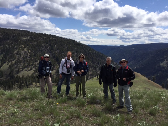
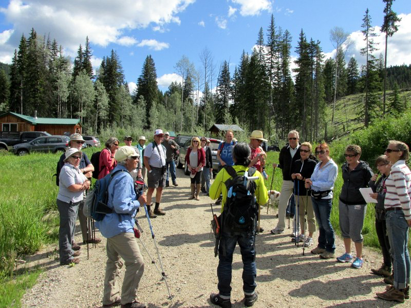
The rains stayed away, but a fierce cool breeze blew as we explored different sites for grass species. It was an informative outing led by Don Gayton who was also our evening speaker. Having an outing in the afternoon, followed by a presentation in the evening was a good format. Something that we could be done more often.
We visited three sites beginning with one off the Coalmont/Tulameen Road just passed the turnoff to China Ridge. Here we started a different type of outing, a meander through Princeton grasslands. Don was delighted with the site and congratulated me for choosing it. It was amazing how much variety was here, and we spent most of our two hours exploring this small area. We learned the names of those elusive plants that surround us, but of which we know little about. I am, one, guilty of saying that all grasses look the same. We were introduced to Cheatgrass, Brome Grasses, Giant Wildrye, Junegrass, different types of Fescue grasses, Spreading Needle Grass, Crested Wheatgrass, and others whose names escape me. Some had interesting

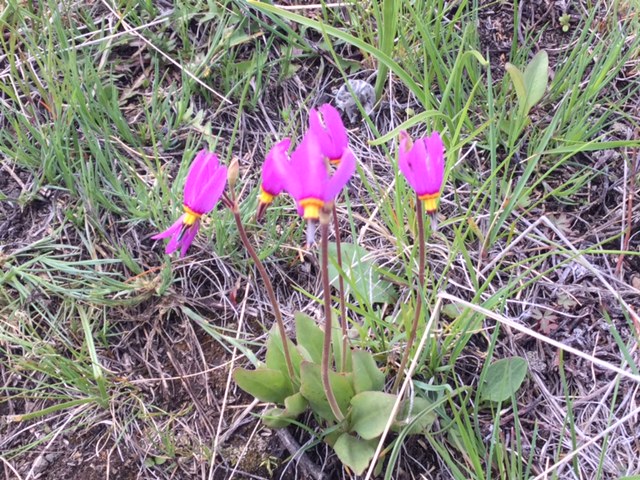
stories such as the Crested Wheatgrass which was introduced to Canada from Russia to restore vegetation to the devastated prairies after the thirties’ drought. It is also good food for cattle. In most instances grasses serve a good purpose, such as enriching the soil by adding nitrogen to it. It’s hard to envision the grasslands without the numerous wildflower that make their home here or even the different wildlife that also call this environment home.
From here we drove to a hillside just pass the KVR on Belfort Road. This area was not as pristine as the first one, but, nonetheless, offered some good choices, such as the Giant Ryegrass and Orchardgrass. Again there were plentiful flowers to admire, amongst them the Sticky Geranium, the Graceful Cinqfoil, and Old Man’s Whiskers, which had truly become whiskers. We also spotted one butterfly, a Variable Checkerspot and one moth, the Mountain Sheep Moth.
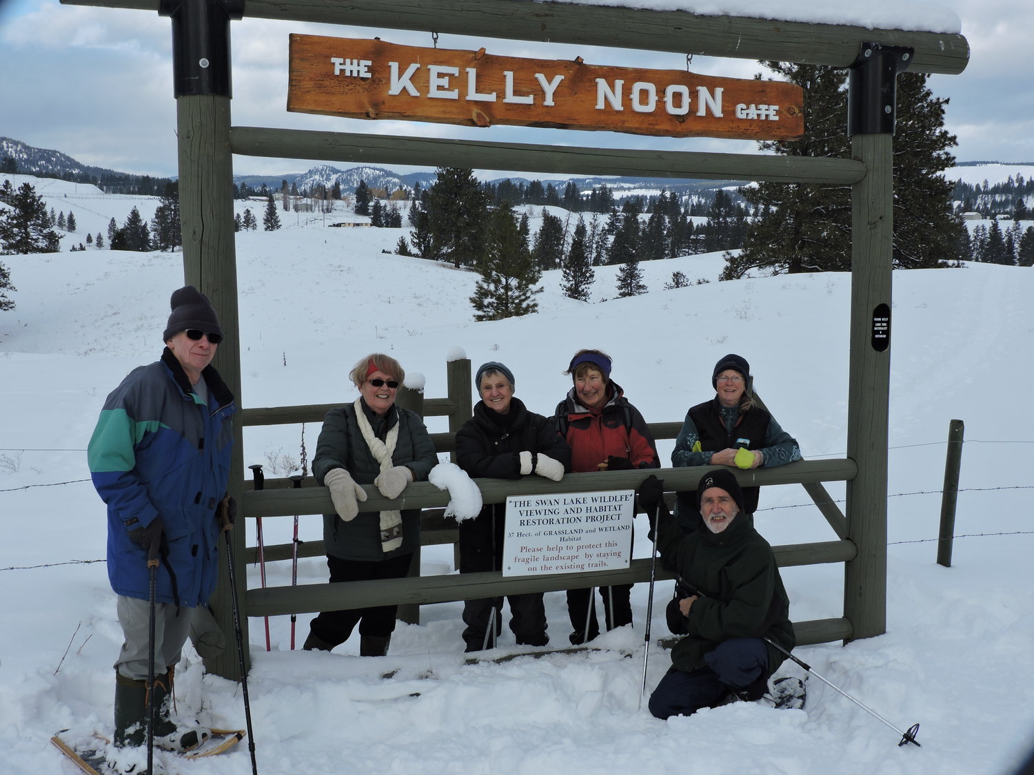
Our last stop was Swan Lake. We did a short walk, noting that many of the existing signposts were no longer relevant because many of the plants were no longer there. It shows that nothing remains static in nature; things are always changing. The plants are still there but in different areas. After a two hour meandering in the grasslands our tour came to an end.

Baldy (Iron Mountain)

Photo: Baldy
Photo by Johanna Nott

The hike up Baldy Mtn aka Iron Mtn on May 6 was attended by 6 people; Cathy and Ed, Peter, Rika, Blain and Johanna. It was a cool clear morning and the meadowlarks sang us up to the top. The balsamorhiza sagittata was beginning its splash of colour on the steep hills. A good rain 2 days previous had filled several ponds where mallard and cinnamon teal were observed. C&E will list the other birds including a red-tailed hawk and a sitting dusky grouse out on a grassy ridge. Heading closer to the top, a swath of few-flowered shooting stars, fritallaria (yellow bell), and western spring beauty confirmed that spring is truly here. Viewing our valley, the town and the surrounding hills from the top always elicits talk of “who’s ranch” and “there’s my house”. Johanna gave a brief history of the people who lived there; the Chisler family who had a zigzag road down to Coyneville, Cox and Meuller who lived on Holmes Mtn, and Bill Budd. Finding a bit of shelter from the chill wind we gingerly hunkered down amongst the prickly pear cactus and had lunch while watching the six mountain goats graze on the far hill. An enjoyable day was had by all in a bucolic setting of green hills with the cows and calves kicking up their heels around us.

Submitted by Johanna

Photo: Baldy
Photo by Johanna Nott

PY Point Picnic

Photo: PY Point Picnic
Photo by Johanna Nott

The Winter Picnic – Hike was a success with the help of Tip Anderson. Fourteen people attended in spite of the rainy forecast which never materialized. I spread wood chips around the picnic table while Tip built up a good fire for roasting all our goodies. Everyone enjoyed cooking and visiting, others went fishing, while some went for the hike on the Dewdney Trail. We didn’t bother with snowshoes so broke through the crust in spots but lots of spots were bare. Cathy, Ed and I snowshoed up there a few days before and there is definitely less snow now (or finally!) I presented a brief history on the Dewdney Trail (1860) and pointed out the rock retaining walls visable in spots. Further discussion by Tip and Tom re: its route through Manning via Wells and Grainger. Also explained how PY Point got its name based on a car accident in 1916. Driver, P.Y. Smith, had 4 passengers with him when the car rolled into the river. Thankfully no one was killed. This part of the road was narrow with a very sharp corner that has since been blasted out and widened destroying a popular swimming hole that Darnella recalls from her childhood.

Swan Lake Snowshoe

Photo: Swan Lake Snowshoe
Photo by Cathy Lahaie

Six members of the Vermilion Forks Field Naturalists and one guest spent about 2 hours snowshoeing the trail at Swan Lake. Part of the trail is new for this winter and it is about 3km in length with a few steeper hills to give you a good workout.

We stopped for a snack break at the picnic table overlooking the lake. The group saw 2 bald eagles, a black-billed magpie and numerous crows and ravens as well as 5 deer and lots of deer tracks. The day was mild after the recent snows with the sun trying to make an appearance.

Photo: Swan Lake Snowshoe
Photo by Cathy Lahaie

Secret Lake Snowshoe

Photo: Secret Lake Snowshoe
Photo by ?

Saturday, January 14th was a little cool at -21 Celcius when 15 members of the Vermillion Forks Field Naturalists ventured to Chain, Secret, Link and Osprey Lakes area.  It was their first snowshoe adventure in 2017.  Local residents of the area also joined the VFFN to bring the group size to 22.  Greg and Terry Tellier from Osprey Lake led the hikers along 8km of trails.

The morning started with a sighting of a juvenile moose at Secret Creek Place just as participants were strapping on their snow shoes.  It was a little windy at times but for the most part the skies were bluebird blue and the sun kept the group nice and warm.

Photo: Secret Lake Snowshoe
Photo by ?

We had some keen birders in the group who identified several species of birds on the four lake trip.

The afternoon ended with a campfire, lunch and last visit to the Budweiser Museum at Tellier’s.

Photo: Secret Lake Snowshoe
Photo by ?

Owl’s Head Hike (Was Kelly Peaks)

Photo: Owl's Head
Photo by ?

On Saturday 3 September eight VFFN members hiked the Owl’s Head Trail near the old townsite of Blakeburn. Our hike that day was supposed to have taken us to Jim Kelly Peak but the weather in that direction was stormy so we decided to hike closer to home.

The hike took us on what appeared to be a very old trail. There were trees along the way that had been slashed many decades ago and were scarred as a result. Around each of them was a piece of coloured tapes saying, “Culturally modified tree.”

The trail goes up and down through the woods and in a couple of places skirts rocky ridges. We, of course, chose to climb onto the ridges to see the views. We could plainly see the area around Jim Kelly Peak, which was surrounded by clouds and streaks of rain, making us glad we had chosen to change our plans. The trees on the ridges were clinging desperately to the rocks and were gnarled and bent from the wind. In the forest there were many dead trees. Thanks to Kelly Cook and the members of the fire suppression crew, all the deadfall had been cleared off the trail; otherwise the hike would have taken us much longer.

After about an hour of hiking we came upon an old adit (a horizontal tunnel driven into the side of a mountain) with narrow rails sticking out of it. It was obviously an old mine and the rails were for the ore carts. The trail we had walked was presumably the trail to the mine. The adit was on a very precipitous slope and we wondered how in the world the ore was packed out and to where. About half an hour after the adit we came to our destination, a ledge on which there were two collapsing cabins. If this was where the people working the mine lived we wondered where they got their water because the valley with running water was several hundred meters down a cliff below us. The dogged industriousness of these early miners blew us away. Above and to the left of us was a rocky cliff on which was the “owl’s head,” a rock formation that, when the light hits it just right, looks like the head of an owl.

On our way back we stopped again at the adit and Peter Antonick decided to go inside. Because the entrance was partially covered with scree he had to crawl in on his belly. Peter was soon followed by Martin and Alexander whose echoey, muffled voices reached us from way inside the tunnel. About twenty meters inside there was a cavern in which the three of them could stand upright. Peter came out with rock samples containing traces of quartz and what look like gold flake but might have been pyrite.

Swan Lake Snowshoe

Photo: Swan Lake Snowshoe
Photo by Cathy Lahaie

We were lucky the weather held for this snowshoe around Swan Lake. Ten of us set out on the loop around the trails with a stop at the picnic table overlooking the lake, hidden by melting ice and snow. This was a short hike of about 2.5 km lasting around 2 hours. There were a few birds to be seen or heard such as a Bald eagle, Crows, Ravens, Black-billed magpie, Steller’s jay and European starlings.

Osprey Lake to Eastmere & Westmere Lakes

Photo: Osprey Lake to Eastmere and Westmere
Photo by ?

The hike from Tellier’s Fisherman’s Cove at Osprey Lake to the lakes of Eastmere and Westmere started under bright blue skies with gentle, refreshing breezes, a round trip of 9 km. Twenty-four nature enthusiasts, amongst them a young hiker, 8 year old Mathias, and a special guest from Russia tromped off with unbridled energy. Following the Tellier’s foot trails, the viewpoints to “Top of the World” and “360” were reached. From “Top of the World” the peaks of the Three Brothers, Snass and Outram stuck out proudly in the mid-morning sun.  At “360” the view was somewhat obscured due to new growth, showing a good forest recovery. Thinking of lunch we renewed our efforts and continued our trip to Eastmere & Westmere, two lovely lakes in the midst of trees. Common loons swam gracefully around the lily-pad lakes while someone reported Spotted Sandpipers along the shore.   Other birds seen or heard on the hike were Spruce Grouse, Red-breasted Nuthatch, Swainson Thrush, Black-capped Chickadee, and Townsend Solitaire. We stopped and had lunch at Westmere. Two adventurous ladies swam in the warm lake, one individual tried his hand at fishing, and others sat and enjoyed the view. The Westmere outhouse was voted the best ever. We returned to Osprey Lake following the “Brunner Trail” which was established over 60 years ago as a foot trail. Also on view along the trails were wild flowers which unfortunately were starting to dry up from the early summer’s heat; however, in damp areas numerous species abounded, amongst these were Columbian Monkshood, Pink Wintergreen, Bunchberry, and Queen’s Cup. Two special treats at the end of the hike were a Townsend Solitaire’s nest built from a projecting sand bank, and a tree which had been marked by bears many times. The woods are full of wonderful surprises!

Vortex Station and Agate Mountain Lookout

Photo: Vortex Station Lookout
Photo by ?

Seventeen naturalists showed up to join Tip Anderson on a drive to Vortex Station and then a hike to Agate Mountain Lookout. Vortex Station is a bearing point for airplanes. From there they can veer off in the direction they wish to follow. Ascending steep steps, we came to a flat area that gave a spectacular view to the west of many visible mountain peaks. There were speculations as to the names of these peaks, but it was difficult to know because of the different angle they were being seen. After a few minutes of admiring the view, we started our hike to Agate Mountain Lookout. The road we followed led us through areas of plentiful flowers which included Tiger Lily, Trapper Tea, Diverse-leaved Cinquefoil, Wild Rose bushes, Bunchberry, and the incredible White Bog-Orchid. “These species occur at low high elevations, in wetlands, seepage areas, subalpine meadows, wet coniferous forests and clearings.” (Plants of Southern Interior BC, Parish et al) A perfect description of the ecology on either side of the road that we hiked. Meanwhile, our lepidopterist, Sue Elwell, saw 12 categories of butterflies. To list just a few, they were Chryxus Arctic, Mariposa Copper, Anise Swallowtails, and Checkerspots. For most of us, the butterflies moved too quickly to truly appreciate what we were seeing. Reaching Agate Mountain Lookout, the group was able to enjoy yet another incredible view of Princeton and surrounding area. The drive down also provided some wonderful vistas, among them a glimpse of Wolf Lake.

Hike to Secret Lake

Photo: Secret Lake (2015)
Photo by ?

Thirteen Vermilion Fork Field Naturalists met thirteen like-minded people from the Osprey Lake area and together they had a good time doing the 2 km hike to Secret Lake, using the Blue Flag Trail that Mark Wong and the Telliers flagged out. The hike began with an explanation from Mark on what had occurred in this area.  A private group logged the vicinity leaving it in a sad state.  A group of people then bought the land with the intention of bringing it back to its natural state.  Their first job was to clear the mess that was left behind and then plant trees.  In this endeavour Weyerheuser proved to be very helpful by donating thousands of tree seedlings.  This new tree growth is every evident at the site.  Leaving the newly planted zone, we walked through a wooded area, stopped, admired, and identified wildflowers, amongst them the beautiful Tiger Lily.  A hawk circled high in the sky on a day that was just perfect for walking. Secret Lake proved to be a special spot.  At one end was a beaver lodge and the surface of the water glistened with lily pads, much appreciated by Barrow’s Golden-eyed Ducks, a turtle that came into view, and a small frog capture by our young naturalist, Karlie Sellmer, for us to admire, then released into the water. We also found a sandpiper’s nest with 4 beautiful eggs.