Osoyoos & Environs

Photo by Sue Delatour

The first stop was the wild sagebrush expanses of the Nighthawk Road that leads to the US border, south of Cawston.  New vineyards and orchards are replacing the existing sagebrush continually; so this important habitat is rapidly declining. We spotted Brewer’s Sparrows, Mountain Bluebirds, Brewer’s Blackbirds, but no Sage Thrasher.  Heading to the summit of Richter Pass, golden bouquets of Arrow-Leaved Balsamroot abounded everywhere. As we drove, we spotted an American Kestrel on a roadside fence post; we stopped and watched with amazement as the poor bird valiantly tried to get airborne with a ground squirrel that almost matched it for size and probably exceeded it for weight.  It made as far as the next post, then the next, and then down to the ground to eat a well-deserved meal!

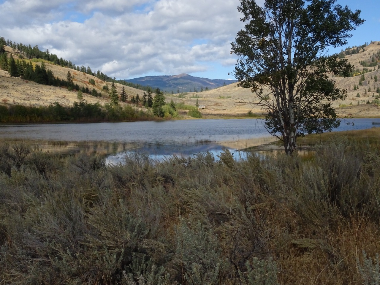
Leaving the Pass, we paused at Spotted Lake, a remarkable natural phenomena.  We turned off onto the Old Richter Pass road and turned right to a small lake where we spent a short time observing the waterfowl.  We sighted Redheads, Gadwall, Bufflehead, and Barrow’s Goldeneye. Meanwhile, whizzing above us, were Violet-green and Northern Rough-winged Swallows.  Due to spring run off, we decided not to take our chances getting in to Kilpoola Lake as the dirt road already had a “Road Closed” barrier across it.

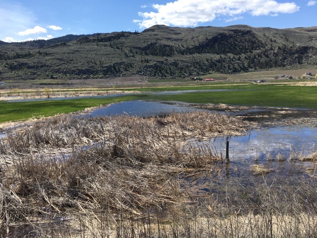
Continuing down the road, we entered the Okanagan Valley.  The valley bottom, now home to famous vineyards and orchards, was originally a vast wetland, especially in spring.  It is now a mecca for birders, especially Road 22. Birding sighting opportunities abound. The hillside, behind the historic barns of the Haynes Ranch, is now a conservation area with hiking trails to the summit of the “Throne”.  We followed the canal side trail of the Okanagan River and saw Tree Swallows, Audubon Warblers, Blue Herons, Northern Shovelers, Hooded and Common Mergansers, a Wilson’s Snipe, and a Say’s Phoebe. Ken set up his scope, and we watched an Osprey sitting on its nest.

We forwent the hike to the throne and headed to Vaseux Lake.  Other than the impressive blind, there was little to see there.  We also forwent the stop at Tickleberry because of the lineup and headed for St. Andrew’s Golf Course.  Tiny streams were flowing down from melting snow making pools near the road. We stopped at one pool and saw Killdeer and a Greater Yellowlegs.  Through Ken’s scope we could see the slightly upturned three inch long beak that differentiates it from the Lesser Yellowlegs with its straight beak.  We stopped at White Lake with the hopes of seeing a Sage Thrasher, but it hadn’t been informed of our visit so it did not show up! However, we did see a small flock of American Pipits and even a Turkey Vulture.  According to Cathy Lahaie we saw a total of 40 species (actually saw not just heard)!

At lower elevations, the Arrow-Leaved Balsamroot was in glorious display, as were the Sagebrush Buttercups, Yellow Bells, Spring Beauty and Small-Flowered Woodland Stars.  Spring had definitely arrived in the Okanagan. It was a rewarding and satisfying outing.

Report by J. Henry; editing M. Masiel

Photo by M. Masiel

Looking for Spring in Keremeos

Photo by M. Masiel

Closer areas still being snow-covered, a small group of us set off down to Keremeos looking for Spring.  Our first stop was the turn off for the Red Bridge. We turned left and parked at the end of the old railway line trail that runs toward Keremeos.  After a few metres, the roar of the highway traffic diminished sufficiently for us to hear bird songs.

Along the trail, we noticed the flowers on black poplar trees and the sweet smell of spring buds.  After a few hundred yards, a couple of Audubon Warblers, Song Sparrows, Juncos and Spotted Towhees provided some interesting moments. Surprisingly, we saw no ducks on the adjoining wetland. We retraced our tracks and descended a trail from the old railbed towards the river.  Hiking through the Black Poplar river lined habitat we discovered a Bald Eagles’s nest with a bird at home. Using Ken’s “spotting scope” we all took a bird’s eye view! We had earlier seen the other half of the pair sitting atop a snag across the highway. Again we followed the trail along the river until we found another prominent trail leading back to our vehicles, a beautiful scenic interesting and highly recommended stroll (allow 1 hour).

Next we drove through Keremeos past the main grocery store and to the concrete plant.  From here, the rail bed continues down the valley, skipping the uninteresting downtown section.  Again using Ken’s scope, we watched a kestrel on a fence post actually dining on a just caught meadow vole! On the power wires, we watched many tittering violet green swallows. We meandered, like the river, crossed its flood plain and perched on riverside logs and ate our lunches, admiring the mist, snow covered mountains and expansive river views.  We chuckled at the California Quail running across our path. Back to our cars and off down the valley to the “amber lights” in Cawston. Turning right and then left and right again, we stopped at the road crossing of Ginty’s Pond, named after Ginty Cawston the founder of this village. This wetlands used to be more open water and early residents travelled by canoe to the post office and held winter skating parties.

Due to roadwork culverts the large pond is now mostly reed covered but we managed to see some American Wigeons and the ubiquitous Mallard before driving down to the end of the pond where we watched Hooded Mergansers.  From here another short stroll took us to the riverbank and back; we sighted a Pileated Woodpecker in this area. All in all, a few pleasant strolls with 20 species of birds identified we felt fortunate to have four seasons of nature at our doorstep or car door!

Report by John Henry

Photo by M. Masiel

Granite City Campground – Winter Picnic

Photo by M. Masiel

You couldn’t have asked for a more glorious, perfect day for a winter picnic. John spent time
clearing the picnic site and even shoveled a walkway to the outhouse! A disappointing number
of members showed up, only 4 (including myself) and 2 invited guests. This was the easiest
outing ever! It was easy, easy, and it could not have been made easier unless you wanted to be
carried on John’s back! Not that he would volunteer to do so.

The group took a short walk to the Tulameen River, only those that wanted; one person
volunteered to stay behind and tend the home fire. We saw numerous ravens and a couple of
Bald Eagles. Afterwards, we had lunch with a roaring fire in the fire pit that John had started an
hour before our arrival.

Everyone opted to pack up and return home, but John and I stayed behind and snowshoed the
perimeter of Granite City townsite. When we arrived in Princeton 37 years ago, we visited
Granite City. At that time more buildings were visible, now only remnants of 3 buildings remain
and all in a sad state of disrepair. It appears that some signage might be going up as we saw
some stakes demonstrating this. Reluctantly, leaving a beautiful sunny day behind, we headed
home. It may not make sense but enjoying such a day can only be done outdoors and enjoying
nature.

Allenby Area Snowshoe

Photo by M. Masiel

Not much remains of the Allenby townsite but it is an interesting area to visit for its natural aspects. It has great potential for snowshoeing and it was the starting point for interested naturalists. A vehicle was left at either end with the anticipation that the foresight would be welcomed at the end of the hike.

The hike began at the industrial remnants near the giant concrete circular concentrator. Starting by stepping on crunchy, crusty snow, the old mine foundry area posed interest, especially an old ponderosa pine snag festooned with giant steel cables and an old iron ladder and even an antique yard light. The tour guide led the group up a steep incline onto an old railway line which once led all the way to the copper mine. Walking south-west for a short distance, the scenery opened with snow-covered sagebrush and expansive views with smells evocative of summer. For this part of the outing snowmobiles had also used the old railway line, as well as elk, deer, coyote and possibly bobcat as indicative by their tracks as they too followed the railbed or crossed it at numerous points.

When the railway line finished, a 1 1/2 km walk ensued to reach the second part of the hike. The trailhead was an old trail descending around landslip knolls which were old drilling sites for zeolite and bentonite (old volcanic ash deposits). Staying on higher ground, thus climbing a considerable amount, for wonderful vistas of the surrounding countryside. The hike was an up and down affair, although there is an old, logging road that could have been used but the views were worth the effort. There were majestic Ponderosa Pines to marvel at and the ever informative guide pointed out this was the case because it prefers drier, warmer and lower elevation, unlike its cousin the Douglas Fir which favours the opposite. Eventually, the Similkameen River came into view, with its giant ice floes and rushing water. Another feature of this area is the hillside which is slowly sliding downwards, leaving exposed giant cracks and exposed outcrops of sedimentary sand and mudstone that contain many Eocene fossils. Two Bald Eagles wheeled overhead and a Red-tailed Hawk was seen viewing the landscape for a possible meal. The total kilometres snowshoed was five taking four hours to complete. It was a leisurely stroll through nature’s wonderland.

Photo by M. Masiel

Kaeden Trail Snowshoe

Photo by M. Masiel

Snowshoe Outing: Kaeden Snowshoe Trail: China Ridge Trails

China Ridge Recreation Area is a great area for winter activities, amongst them is snowshoeing. The Area is located about 9 kms from town on the West China Creek Road. It is simple to get there; follow the road to Coalmont, turn on West China Creek Road, follow this road until it finishes at a parking lot and at the China Ridge Longhouse, a facility open to the public located at the trailhead. The main winter activity at China Ridge is cross country skiing. The trails are groomed and the public is reminded to use these trails only for skiing. There are separate trails for snowshoeing and for skiing with dogs.

The trailhead for the Kaeden Snowshoe Trail starts at the fence to the extreme right; a sign showing a snowshoer marks the beginning. This trail is definitely separate from the ski trail or the dog trail. A steep beginning, it eventually levels out. This trail crosses the main ski trails and care must be taken to do as little damage as possible to the ski trails. The Kaeden Snowshoe Trail meanders through a wooded area parallel to the China Loop Cross Country Ski Trail. Trees bowed by snow posed a fantastic winter scene. The terrain is somewhat varied making it more interesting that just flat expanses. Track evidence of deer, elk, snowshoe hare and shredded bark tree marking showing antler rubbing activity were seen; as well, Pine Grosbeaks were spotted along the way. A person can cut the trip short by taking the short cut and returning back to the parking lot or continuing on to China Loop Shelter.

Here, the tour leader, John Henry, had a fire going, having skied to the site prior and then returning to greet the group doing the hike. Arriving too early for lunch the group decided to add an additional loop that brought them back to the shelter to have lunch. From the shelter, it is possible to do a return trip using a different trail that also parallels the ski trail. The tranquility and the beauty of nature makes this outing a worthwhile venture. The snowshoe trail is 4 kilometres in total and takes about 2 hours to do.

Photo by M. Masiel

Urban Stroll

Photo by Cathy Lahaie


When this walk was first suggested early last year, I had envisioned a late fall day with China Creek (as locals refer it to) or Asp Creek (named by the government) as a mere trickle. However, weather being what it has become (unpredictable) we found a creek with a considerable flow and snow on the ground! Nonetheless, a jolly atmosphere prevailed amongst the 11 participants doing the hike.

This area of about a kilometre or so follows China Creek, a wonderful oasis right in town. We were delighted with the magnificent Black Poplars, quite numerous in this ecosystem, especially when we gazed in awe at one that measured 14 feet 6 1/2 in circumference or 4 feet 7 inches in diameter! Also on view were Brown and Silver Birches, Douglas Firs, and Ponderosa Pines, all in wonderful, healthy condition.

A Kestrel was sighted even before we began our hike; other birds seen were the Pileated Woodpecker, Clark’s Nutcracker, Red-Breast Nuthatch, Mountain Chickadee, and a noisy squirrel (not bird related!).

Following a wooded path, we were surprised to find ourselves in an open meadow that continued for a short distance. We crossed the creek four times, then we followed a trail or path that eventually came out at the far western end of the airport. Here a good road takes you back to civilization, but we chose to come down the side hill and arrived in our backyard. The hike took two hours with many stops to admire the scenery and views.

Photo by Mary Masiel

Cinder Cone

Photo by Mary Masiel

Cinder Cone is an old volcanic plug or basalt plug. Originally John named it Cinder Cone, but there is no ash just gravel-like pieces of basalt lava. So it’s a misnomer, but it is fondly referred to as Cinder Cone. It was a favourite area for mountain bikers who rode their bikes from town up the East China Creek Road to about kilometre 5 then took a right on a road that led to the top. The last part of the road was always a challenge to some because it of it steepness. Once the view was admired they headed down a steep trail on the other side.

It was this steep trail, that we were looking for on Saturday but somehow managed to miss it. We meandered through a Ponderosa Pine and Douglas Fir forest and encountered numerous sighting of the Clark’s Nutcrackers who seem to favour this type of trees. We also sighted a Pleated Woodpecker, Hairy Woodpecker, an immature Golden Eagle, Red-breasted Nuthatch, the usual chickadees, and heard either Gold-crowned or Ruby-crowned Kinglets. The woods was alive with the “sound of birds”. Unfortunately, John was the only person who knew anything about bird identification; unless he saw them, he found it hard to identify them by song.

The hike was quite pleasant with glorious sunshine whilst the rest of the valleys were still covered in mist. The one aspect that marred the hike was all the dead fall that we had to step over. Eventually, we came across the trail coming down from the top and we were able to follow it and were justly rewarded with magnificent views in all directions; the valley bottoms were just coming out of the mist. We did a quick trip to the pond which was virtually dry and not of much interest. We decided to walk back to the car following the East China Creek Road and thus avoiding all the deadfall.

The total hike took 3 hours with a stop at the top for an early lunch.

Photo by Mary Masiel

Holmes Mountain

Photo by Stella Holiday

Met at Billy’s at 10:00 am and filled the cars to capacity to minimize the number of cars parking at the pullout near the Iron Mtn locked gate. Linda Allison had informed me about mining activity on Baldy and sure enough several large trucks were on the narrow road.
There were 8 participants and 1 leashed dog on the hike to Holmes Mtn. Strong winds whipping golden grasslands and racing clouds across a blue sky made for a pleasurable 10km hike (one way). Lunch break was at the high meadows of the Cox & Euller homestead with dramatic views across the Similkameen Valley.

Birds identified:
Red-tailed Hawk, Grey Jay, Clark’s Nutcracker, the ever present Crow, Pine Grosbeaks and a “v” of unidentifiable ducks.
Elk tracks in the mud were noted.

Photo by Johanna Nott

Palmer’s Pond

Photo by Mary Masiel

“Palmer Pond, near the Cascade Divide, is named in respect of Lieutenant Palmer of the Royal Engineers. He crossed the divide in 1859.

The pond is situated alongside a portion of historic Hudson’s Bay Brigade Trail. This trail was used in the mid-1800’s to transport goods by horse between Hope and Tulameen. The trail is easy to follow — courtesy of literally hundreds of forefathers’ day pack horses that, in places, have trod the trail knee-deep into the soft earth.” trailpeak.com.

There are some things that you need to know about Palmer’s Pond. It is exactly 2 hours drive from Princeton to the trailhead. From the turnoff to Jacobsen Lake,you will see homemade sign that points out FALLS, presumedly Tulameen Falls because it is in that general area, and a highway sign advertising Vuich Falls. You will pass Vuich and Sutter Creek Campsites.

Stutter Creek is a lovely camping area, but at the moment occupied with hunters. The trailhead for Palmer’s Pond (at kilometre 46) is just beyond Jacobsen Lake. The hike to the pond is 3.5 kilometres if you’re feeling in top shape but 4 kilometres if you are not. It is all in the perception! The round trip will take 3 to 4 hours, either way it is a worthwhile hike that gets a hiker to the alpine very quickly and thus to the incredible views that one experiences in that habitat.

However, our experience on Saturday, Oct. 14th was somewhat different. We had overcast skies; the weather forecast did say that conditions would improve by afternoon, but it did not. We started to experience snow even before the turnoff to Jacobsen Lake; beyond Vuich Creek the snow deepened to about 6 inches; past this point hunters are not allowed to drive. Since we were not hunters, we continued on the road. We did see some hunters walking about, a most unusual sight.

We did have snowshoes but left them behind in the truck and trudged on the snow filled trail. We reached Palmer’s Pond at 6100 ft. with a snow accumulation of 12 inches or 1 foot of snow! Meanwhile, a very heavy mist moved in and nothing was visible; we could just about see the edges of the pond. In spite of this everyone’s spirits were high and we were congratulatory having reached our destination regardless of nature’s lack of cooperation.

Having the Lahaies with us was a bonus because they can always identify birds. We saw Gray Jays, flocks of Gray-crowned Rosy-Finch, Golden-crowned Kinglet, Pacific Wren, and Black-capped Chickadee. It is now definitely winter in this part of the world.

Photo by Mary Masiel

Kilpoola Lake Area

Photo by Mary Masiel

Some of the Kilpoola area is managed by BC Nature Trust and the Nature Conservancy of Canada. It is designated as an important birding site. From Highway 3, we took the turnoff to the Old Richter Pass Road and then onto Kruger Mountain Road. We were hoping to see lots of autumn colours, and we weren’t disappointed; although, a complete change has yet to occur.

At the first lake (no name) we anticipated seeing turtles but none were visible. We did, however, see a very pretty pink water lily that immediately caught my eye. It was identified as a Water Lady-thumb, (polygonum natans).

Numerous dragonflies flickered in and out of the marshy part of the lake; it was neat to watch them with binoculars. The most interesting aspect of this lake was how it mirrored a Monet painting.

Our next stop was Blue Lake, a rather large, tranquil lake. We scared off a couple of Mallard ducks and saw a Says Phoebe, as well as, a Ruby-crowned Kinglet flying above us in the tall pines.

At Kilpoola Lake, we parked the vehicles and when we got out, we were immediately assailed by the strong pungent scent of sagebrush. We took a short walk along the edge of the lake, admiring the scenery. This is a beautiful grassland area. Two fishermen in a boat occasionally broke the silence in an otherwise very quiet and peaceful environment. Here, we saw American Coots, Gadwall Ducks, and Pied-billed Grebes. On the way back, we met a couple biking along the trail. Biking this area is a good way to see and appreciate what nature has to offer.

Leaving Kilpoola Lake we went up to the next lake which also has no name. Here we saw hundreds of ducks, but too far away to be identified. We could have walked toward them, but we did not want to frighten them away.

The group’s comments on the Kilpoola area were, “The scenery is just spectacular.” “It’s just so beautiful.” “You can hear the silence; it’s so peaceful, so restful”.

We left this wonderful area and proceeded on to our next stop, the wildlife observation site on Vaseux Lake. The new three tier bird blind is a great improvement. It is a good observation site, but again the birds were too far away to identify.

Finishing our little expedition, we stopped at Tickleberry’s to enjoy a treat.

Photo by Mary Masiel