Sheep Rock

Photo by Martin Hough

A smoked filled Similkameen Valley did not bode well for our hike. As we got closer to Hedley we could see that the Diamond Creek Fire was having an effect. However, once we arrived at our destination, on the other side of Apex Mountain, conditions improved. The day proved to be a fine one, overcast skies with brief bursts of sunshine.

From the Apex Road we made a turn at Shatford Road which leads to the Sheep Rock trailhead. The road was somewhat rough, but our driver managed to get us through with considerable skill. This road continues on to the Brent Mountain Trail.

The trailhead was easy to find unlike the previous time that John and I were there. From the trailhead, the path goes sharply down; some fallen trees forced us to go across a very muddy area, a surprise considering how dry it has been. In this area we did see some berries, one yet to be identified and the other, the 5-Leaved Bramble (Rubus pedatus). Thereafter, the trail was well defined, and we could see that much deadfall had been cleared, probably at the start of the hiking season, but in spite of this more trees had fallen after the cleanup.

The trail meandered uphill through a widely spaced forest, and as we gain elevation we were surprised to be surrounded by Whitebark Pine! Still in the forest, John alerted us to Sandhill Cranes flying above us, barely visible, about 60 or so. At the lower meadow dry pond beds indicated that it had been a busy habitat during the summer. We stopped for lunch in this meadow and were again rewarded with the sound of Sandhill Cranes flying overhead. This time they were visible; no trees obstructed our view. In total we estimated 200 to 300 cranes. We were absolutely delighted!

After lunch we continued our uphill climb to reach the upper meadows where we could see the remnants of what must have been an incredible floral display. Now, the plants and flowers were a different colour; instead of vibrant primary colours, they were muted yellows and browns, but some were brilliant oranges and reds. The blueberry bushes, for example, were now a striking vermilion. At the very top we encountered some hardy lupines and yarrow still in bloom, amazing!

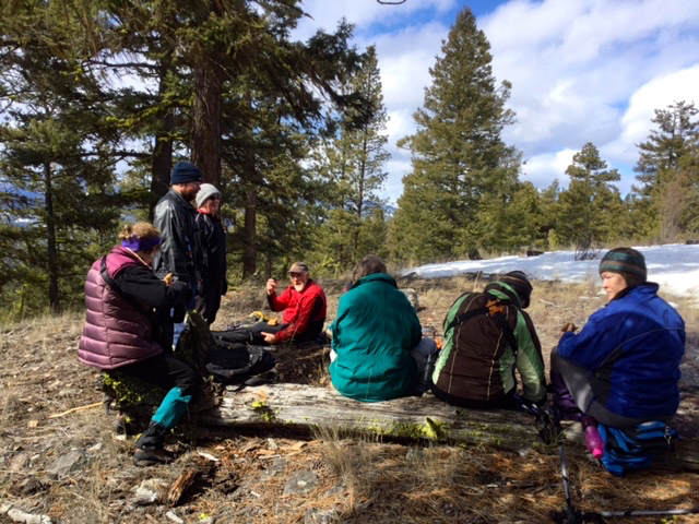
As we congratulated each other in having reached the top, the weather deteriorated, and the wind was bitterly cold. Having had some considerable foresight, we donned our toques, mittens, and warm jackets. From our vantage point, we could see the fire lookout on Brent Mountain. We, also, got a good look at the surrounding valleys; some covered in smoke others with dark, heavy threatening clouds. We did a quick retreat; those mean clouds promised rain. The rain came down just as we got to the car. How lucky was that?

The hike was about 10 to 12 kilometres and took 4 hours. Although not technically difficult, it was a long day. It was worth it; an opportunity to see nature in a different season and admire all it had to offer.

Photo by Mary Masiel

Stemwinder

Smoke did not deter 6 determined naturalists to hike up Stemwinder Mountain, Saturday, August 5th. Actually, the higher we went the less smoke we encountered. The smoke was almost negligible by the time we got to the top.

Nature is a real marvel. Every few weeks “out goes the old and in comes the new!” I was not expecting any flowers, but I was wrong. What’s in bloom? FIREWEED or ROSEBAY WILLOW HERB (Epilobium angustifoluim) with its bright, brilliant pink fuchsia coloured flowers was in bloom everywhere. We stumbled across the YELLOW TOADFLAX (Linaria vulgaris). It was a stumper until Stella later identified it. It is a far daintier than its cousin, DALMATIAN TOADFLAX, but still considered an invasive weed. We vied for position to photograph bees feasting on CANADA THISTLE (Cirsiym arvense). Clear area were festooned with GIANT MULLEIN (Verbascum thapsus). Further along we saw a rabbit that froze, pretending that we couldn’t see it, amongst white daisies, OXEYE DAISIES, (Leucanthemum vulgare). Up on the top, we came across the SULPHUR BUCKWHEAT (Eriogonum umbellatum). Remnants of SHOWY DAISIES (Erigeron speciosus) and YARROW (Achillea miffefolium) were still evident. I managed to identify yet another lichen, HORN CLADONIA (Cladonia cornuta).

Other features were pointed out by John. On our way up John pointed out “muck piles” indicating small mine exploration, and we explored a small meadow where a corroding woodstove and bits and odds scattered about gave evidence of an existing camp in the distance past. As the path started to climb, John noticed a mine adit which had been overlooked in past hikes, and everyone had a quick look inside.

Reaching the top, our view of the area was obstructed by smoke in the distance, but we experienced a wonderful cooling breeze. We congratulated ourselves, being on top, instead of down in the “pea soup” condition that existed in the valley. It was a satisfy walk more so as we headed down to the Hitching Post for lunch.

Hope Pass

It was another warm July day as nine of us led by Charlotte Sellers hiked the Hope Pass wagon trail built in 1861. The last part of the drive was over a severely rutted road, but the SUV and pickup handled it well, although at very low speed. There were actually clouds which have been rare this summer, moving east quickly; this and the high altitude kept the day cooler than other days in town. The elevation of the pass is 1839 m as per the sign post – almost the same as Mt. Kobau.

The wild flowers were blooming in great profusion – white, yellow, red and blue mainly. The marmots were active in Marmot City, just past the summit where we stopped for lunch. We then continued down the west side a bit until it got a bit steep, and we turned back. The heat hit us when we arrived back in Billy’s parking lot about 3 pm having left at 8:30. We were glad to have been in the flowery hills for the day.

Overall, to quote Rika (without permission), “The flowers were worth the price of admission”.

Ponderosa Pine Reserve

Photo by?

A glorious summer day greeted 10 very enthusiastic walkers as they headed up the hill to explore an area known as the Ponderosa Pine Reserve with Warden Charlotte Sellers. We encountered numerous species of flowers and one not yet seen this year, the Round-Leaved Violet, Viola orbiculata, or Yellow Violet as it is commonly called. Actually there are 2 species that look similar but called by different names, the Round-leaved Violet and the Stream Violet. The Round-leaved Violet appeared in profusion in the meadows whilst the Stream Violet populated the grounds around Lamont Creek. Others flowers seen, were the Lemonweed, Fairyslipper, Arrow-leaved Balsamroot, Bullhead Waterleaf, Small Flowered Woodland Star, Oregon Grape, Lockspur, Small Flower Blue-eyed Mary, and lots of Wolf Lichen on the Ponderosa Pine.

We meandered up steep hills with occasional stops to admired and photograph the flowers. We arrived at the highest point to have lunch and after lunch we went along a ridge then down again to the fast flowing Lamont Creek. We followed a dubious trail (cow track) along the banks of Lamont Creek; all of which was very pleasant. In no time at all we were back at the cars. It was a most pleasurable hike.

Mount Kobau

Photo by Cathy Lahaie

The Mount Kobau outing was a wonderful trip.  We savoured the experience long after we were finished.  We arrived early; Lee Mcfayden, our tour guide, arrived on time.  While we waited, we immediately began exploring the side of the road and were rewarded with an incredible variety of flowers.  Some that we had seen before, others not.  The trip itself became one of admiring flowers and discovering ones that we as a group had not seen before.  To name a few, the Thompson Paintbrush that looks nothing like its cousin the Indian Paintbrush; it has a greenish white upper part and we were told by Lee that it is unique to this area.  The Silverleaf Phacelia, the Siberian Elm, an introduced species of trees, Narrow-leaved Collomia, Single Flower Broomrape, a parasitic flower blooming amongst the Round leaved Alumroot, Hillside Milk Vetch, pink and white bitterroot (first time this season), and white Penstemons, all were an awesome treat for us.  This was one of those rare moments that you could immerse yourself in an explosion of colour and become part of a painter’s canvas.
Lee, always a fountain of information, told us the story of Mount Kobau.  It is referred to as the “Million dollar road that goes nowhere.” There were big plans for Mount Kobau, elevation 1873 metres (6145 ft.)  It was chosen to be the site of a large astronomical observatory.  The proposed telescope was to cost $15—$17 million.  The 381metre (150 in.) optical telescope would be the second largest in the world and it was to be named the Queen Elizabeth II Observatory.  Such plans did not materialize because the cost kept rising.  So today all that is left is a proper size road which makes the going up relatively easy.
As we continue up Lee pointed out water leaking from the rock and explained how man changes the environment.  In building the road the groundwater was exposed; and thus, the water now runs down the rocks and along side the road.  A simple observation that would have gone unnoticed unless someone pointed it out.
The road goes up and up until the top is reached.  With each gain in elevation the flora changed; beginning with the Thompson’s Paintbrush and ending with Spring Beauty and Sagebrush Bluebells at the top. The last two flowers, we saw a month ago in the White Lake to Mahoney Lake trip.  That’s what made this trip so exciting!  It was like an archaeological trip in reverse.
The area higher up had been devastated by forest fires, but new growth was evident.  We found a picnic table at the parking lot and had lunch before we hiked to the top.  At the top we had a splendid view of the surrounding area and the views continue to be stunning as we made our way down.  At the end, we felt self-satisfied, felt that we had learned much, seen a lot, and just enjoyed the camaraderie.

Photo by Mary Masiel

Grasslands

Photo by Mary Masiel

The rains stayed away, but a fierce cool breeze blew as we explored different sites for grass species. It was an informative outing led by Don Gayton who was also our evening speaker. Having an outing in the afternoon, followed by a presentation in the evening was a good format. Something that we could be done more often.
We visited three sites beginning with one off the Coalmont/Tulameen Road just passed the turnoff to China Ridge. Here we started a different type of outing, a meander through Princeton grasslands. Don was delighted with the site and congratulated me for choosing it. It was amazing how much variety was here, and we spent most of our two hours exploring this small area. We learned the names of those elusive plants that surround us, but of which we know little about. I am, one, guilty of saying that all grasses look the same. We were introduced to Cheatgrass, Brome Grasses, Giant Wildrye, Junegrass, different types of Fescue grasses, Spreading Needle Grass, Crested Wheatgrass, and others whose names escape me. Some had interesting

stories such as the Crested Wheatgrass which was introduced to Canada from Russia to restore vegetation to the devastated prairies after the thirties’ drought. It is also good food for cattle. In most instances grasses serve a good purpose, such as enriching the soil by adding nitrogen to it. It’s hard to envision the grasslands without the numerous wildflower that make their home here or even the different wildlife that also call this environment home.
From here we drove to a hillside just pass the KVR on Belfort Road. This area was not as pristine as the first one, but, nonetheless, offered some good choices, such as the Giant Ryegrass and Orchardgrass. Again there were plentiful flowers to admire, amongst them the Sticky Geranium, the Graceful Cinqfoil, and Old Man’s Whiskers, which had truly become whiskers. We also spotted one butterfly, a Variable Checkerspot and one moth, the Mountain Sheep Moth.
Our last stop was Swan Lake. We did a short walk, noting that many of the existing signposts were no longer relevant because many of the plants were no longer there. It shows that nothing remains static in nature; things are always changing. The plants are still there but in different areas. After a two hour meandering in the grasslands our tour came to an end.

Baldy (Iron Mountain)

Photo: Baldy
Photo by Johanna Nott

The hike up Baldy Mtn aka Iron Mtn on May 6 was attended by 6 people; Cathy and Ed, Peter, Rika, Blain and Johanna. It was a cool clear morning and the meadowlarks sang us up to the top. The balsamorhiza sagittata was beginning its splash of colour on the steep hills. A good rain 2 days previous had filled several ponds where mallard and cinnamon teal were observed. C&E will list the other birds including a red-tailed hawk and a sitting dusky grouse out on a grassy ridge. Heading closer to the top, a swath of few-flowered shooting stars, fritallaria (yellow bell), and western spring beauty confirmed that spring is truly here. Viewing our valley, the town and the surrounding hills from the top always elicits talk of “who’s ranch” and “there’s my house”. Johanna gave a brief history of the people who lived there; the Chisler family who had a zigzag road down to Coyneville, Cox and Meuller who lived on Holmes Mtn, and Bill Budd. Finding a bit of shelter from the chill wind we gingerly hunkered down amongst the prickly pear cactus and had lunch while watching the six mountain goats graze on the far hill. An enjoyable day was had by all in a bucolic setting of green hills with the cows and calves kicking up their heels around us.

Submitted by Johanna

Photo: Baldy
Photo by Johanna Nott

White Lake to Mahoney Lake

Photo: White Lake to Mahoney Lake (2017)
Photo by John Henry

A beautiful Spring day greeted us at White Lake as we started on our hike down to Mahoney Lake. This region is sagebrush and ponderosa pine, quite different ecology from Princeton. The White Lake formation is Eocene lava flows and fossiliferous shales from over 35 million years ago. This area is referred to as grasslands and is under the Nature Conservancy stewardship.

We saw many wildflowers, some of which we struggled to identify; some so small that a magnifying glass would have been helpful. The Sage Buttercups, Sage Bluebells (a new species for our group), and Spring Beauties were in great profusion. They provided a wonderful canvas of delicate colours amongst the sagebrush.

The birders recognized 38 species, including 12 white pelicans overhead and higher still a lone Sandhill Crane. We were delighted by the Audubon Warbler (butter butts, as the Lahaies call them), the Nashville Warbler, the Hairy Woodpecker, the Nuthatches, and others as they flickered in and out of trees. After our 6 kilometre stroll (I think that the hike will be classified as easy for next time) we reached Mahoney Lake with its deadly poisonous hydrogen sulphide layer, a very strange natural wonder. The wild asparagus, a few stems that were found, were later cooked and were declared absolutely delicious. We finished our outing with a trip to Tickleberry for ice cream to restore our strength.

Little Darcy Mountain

Photo: Little Darcy Mountain
Photo by ?

The field trip to Little Darcy Mountain was entertaining, educational, and a sight-seeing delight. Although we saw evidence of elk, they weren’t around but with the use of binoculars we could see the elk down at the Young Life Village. We heard the flutter of wings which indicated that the grouse were around as they took shelter in the pines, but we weren’t able to spy them. We heard the sounds of Mountain Chickadees and the Pileated Woodpecker and saw Red-tailed Hawks, Mountain Bluebirds and in August Lake we sighted Bufflehead, Mallards and Canada Geese. These ducks were all seen in pairs, getting ready for that all important mating season.

On the hike our “esteemed” leader pointed out small things found on the ground but always overlooked, such as the Shaggy Peat Moss (Sphagnum squarrosum), Freckle Pelt-Leaf Lichen (Peltigera apthosa), Ribbed Scale Lichen (Cladonia cariosa), and Wolf Lichen (Letharia vulpina). We learned that there is a distinct difference between moss and lichen and that they are worlds apart.

Wolf lichen was used by interior native people as a yellowish-green dye to colour fur, moccasins, feathers, wood and other articles. The Nlaka’pmx used it as a body and face paint. The genus letharia means deadly or lethal and refers to the poison found in it, vulpinic acid. It was used in Europe as wolf bait; it’s found in open Douglas fir forests. Freckle Pelt-leaf Lichen’s habitat is over moss, humus, rocks, and decaying logs in open forest. The “warts” on the upper surface contains tiny colonies of blue-green cyanobacteria which supply the lichen fungus and its green algal partner with nitrogen. Ribbed Scale Lichen is found over humus and soil in open dry forests and grassland at all elevations; its favourite place is disturbed areas. Shaggy Peat Moss’ habitat is low subalpine elevations; seepage areas in woodlands; also in wetland, but not bog species. The native people of BC, including in the interior, used the soft, absorbent qualities of sphagnum moss; it was used widely for bedding, sanitary napkins, and baby diapers. All the above information on mosses and lichens was taken from the book, Plants of Southern Interior British Columbia, (Parish, Coupe’, & Lloyd), pages 435, 418, 416 & 384 respectively.

As we meandered through the meadows we saw our first Spring Beauty, a delightful, delicate, beautiful, little flower; the mountainside was now also covered with Sagebrush Buttercups.

Eventually, as we headed down the only real steep part of the hike; we came upon the exposed area of rocks containing copper ore (malachite). It is an area that always entrances the hiker because the lovely colours of blues and greens that the rocks exhibit.

Although the day began with glorious sun, by the time the hike finished, the weather had taken a threatening turn. We made it to the cars before the rain started.

Timberhill

Photo: Timberhill
Photo by Johanna Nott

Either way you approach Timberhill, it is a bit of an uphill walk.  This time the naturalists chose a route  opposite August Lake.  As we started out we could see a frozen August Lake with little wildlife present.  The round trip of 5 kilometres was a pleasant one and a good way to spend a Saturday mid morning and early afternoon, starting at 10:00 a.m. and finishing at 1:00 p.m. For the most part the ground was bare with some patches of snow.   Along the way we saw tiny buttercups just ready to burst upon the scene.  There were also remnants of last year’s  Arrowleaf Balsam and most likely this flower will be plentiful when the right time arrives.  Reaching the apex of the mountain we hiked down a bit to get a better look at the town and environs.  It’s always fun to try to locate one’s house with the comment, “ah, is there where we live?”  We returned to the top of the mountain, and John built a nice campfire, and we had lunch.  The warmth was appreciated because a strong southern wind started to blow, but the sun did come out to add to our warmth.  The Lahaies identified for us a Williamson Sapsucker, a mature eagle, an immature eagle, Mountain chickadees, and a White Breasted Nuthatch.  As we headed down the mountain, threatening clouds from the south were fast moving towards us, but we finished the hike without any weather incidence.  A Red-Tailed Hawk escorted us as we drove toward Princeton.